MØNS KLINT
-
Location: Island of Møn, Denmark
Nearest Town: Borre
Known For: Dramatic chalk cliffs, fossil hunting, beech forests, and sweeping Baltic Sea views
Elevation: Up to ~128 meters above sea level
Trail Type: Forest + cliffside loop trails, often steep and narrow
Hiking Difficulty: Easy
Wildlife: Roe deer, foxes, woodpeckers, and rare orchids in spring
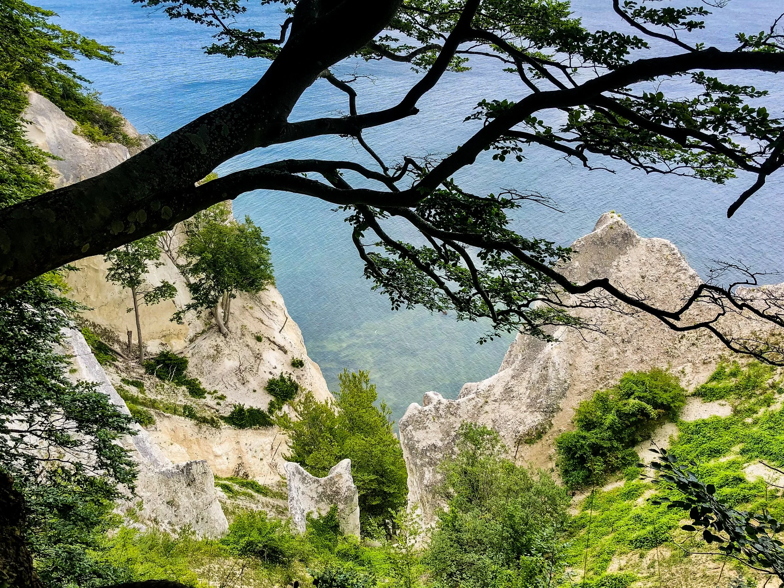
Geology: White chalk cliffs formed 70 million years ago during the Cretaceous period
Fun Fact: Møns Klint is part of a UNESCO Biosphere Reserve and one of Denmark’s most iconic natural landmarks
Best Time to Hike: April to October
-
🚗 By Car (Recommended)
~1 hour 45 minutes from Copenhagen
Route: via the E47 and Queen Alexandrine Bridge, with free parking near GeoCenter Møns Klint.
-
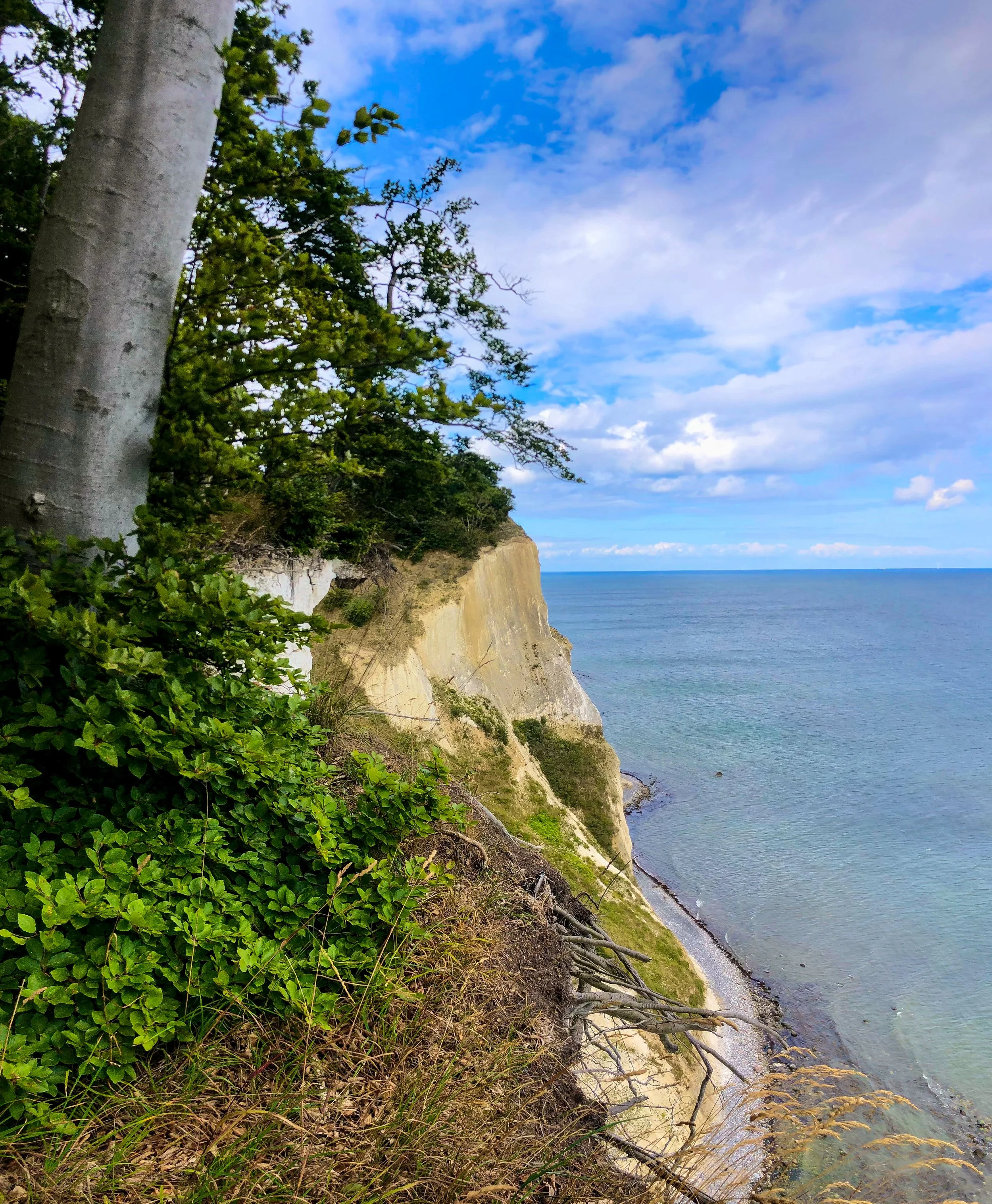
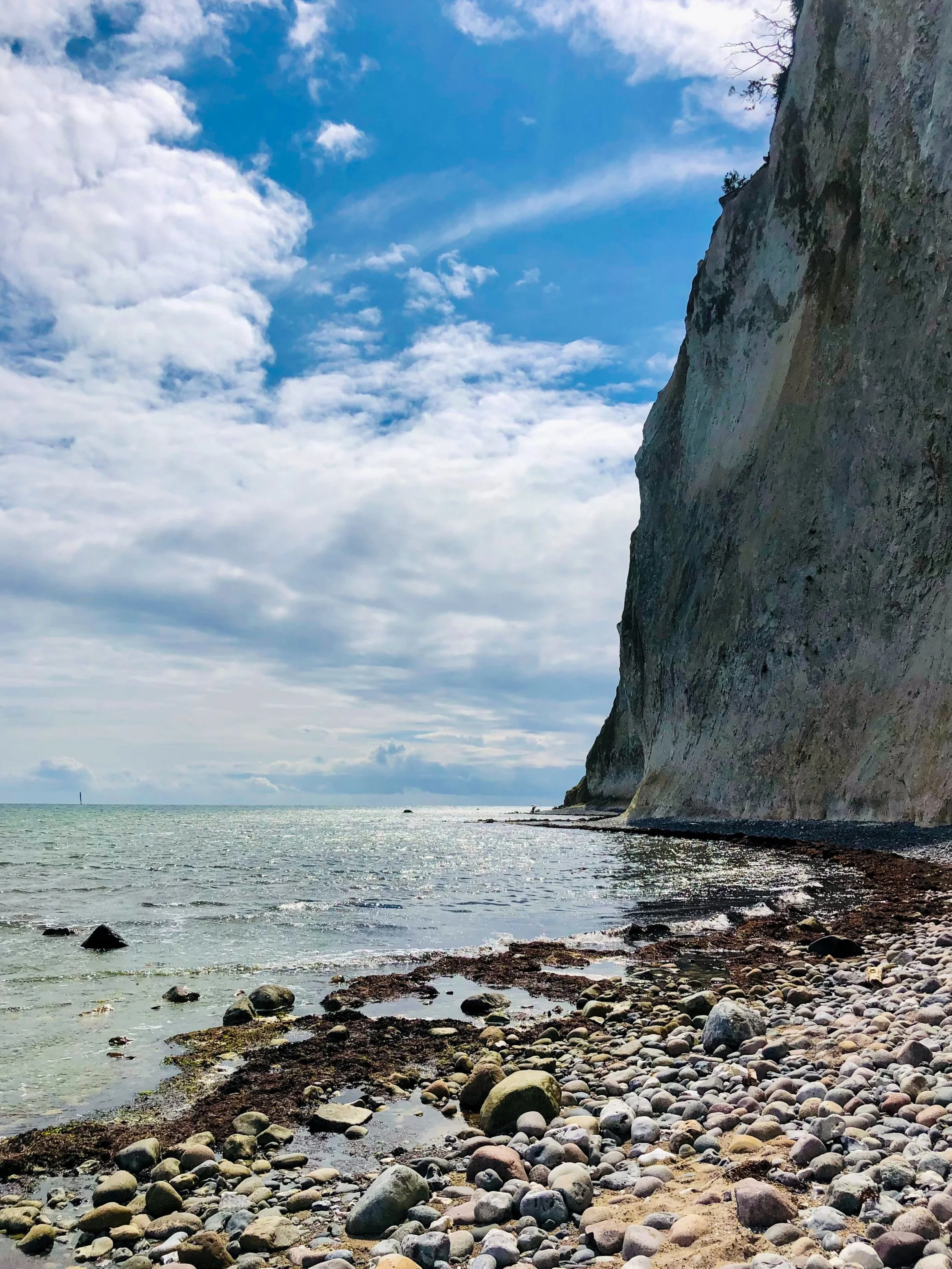
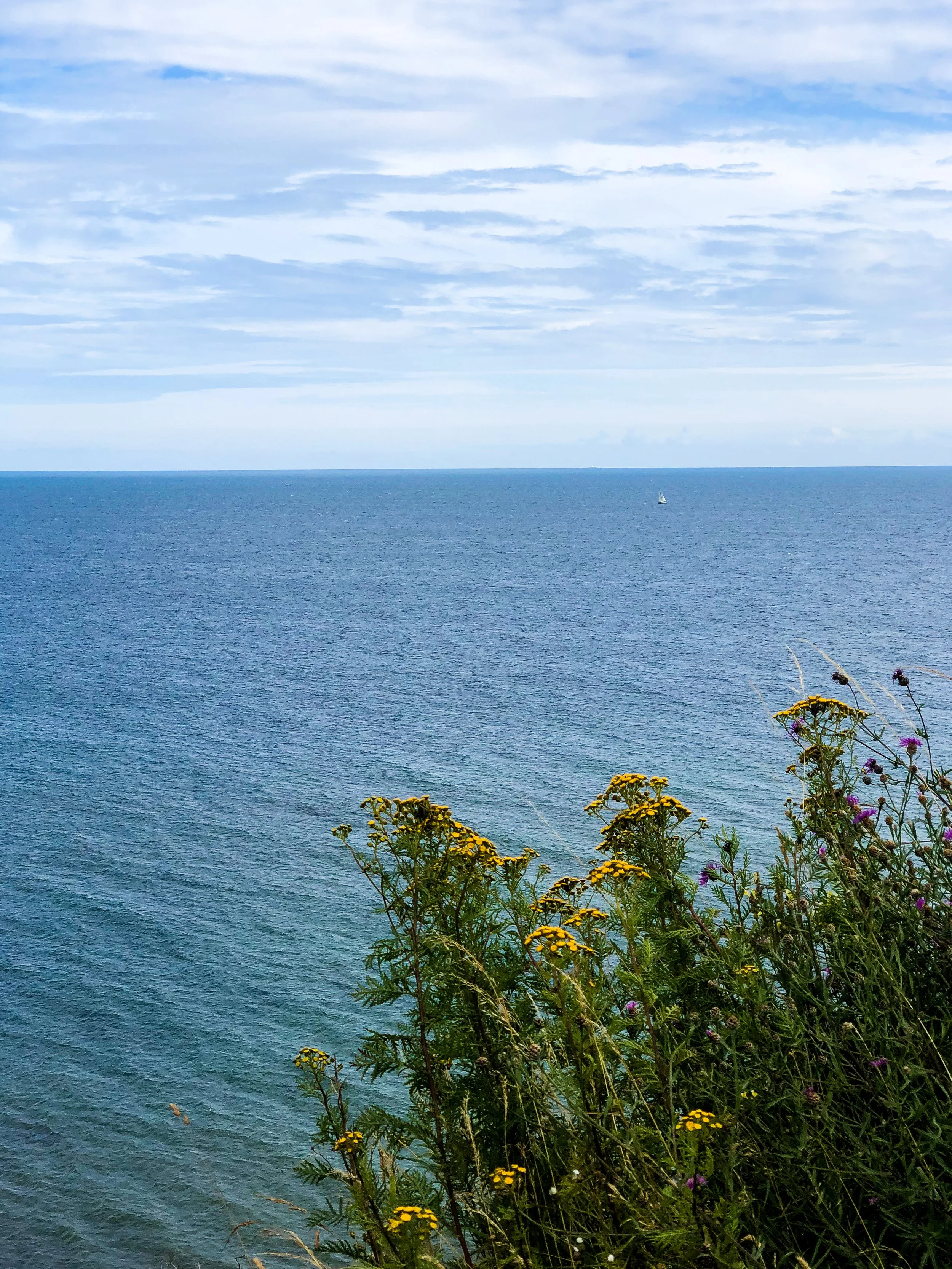
The cliff edge near Maglevands Nakke, where the beech forest disappears and the sea hits you with that whoa, I’m tiny feeling 🌊🌳
Hiking the Edge of Denmark
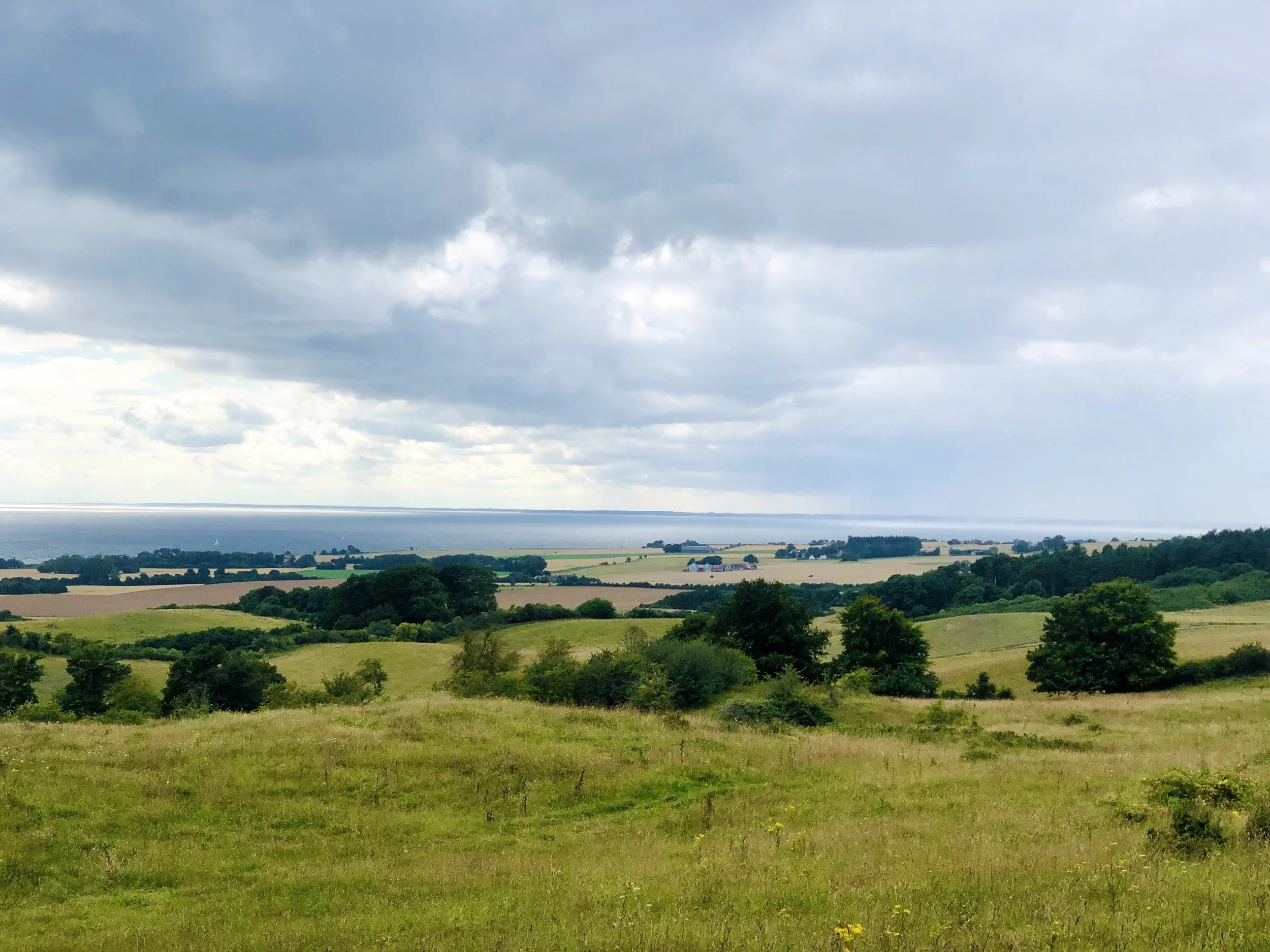
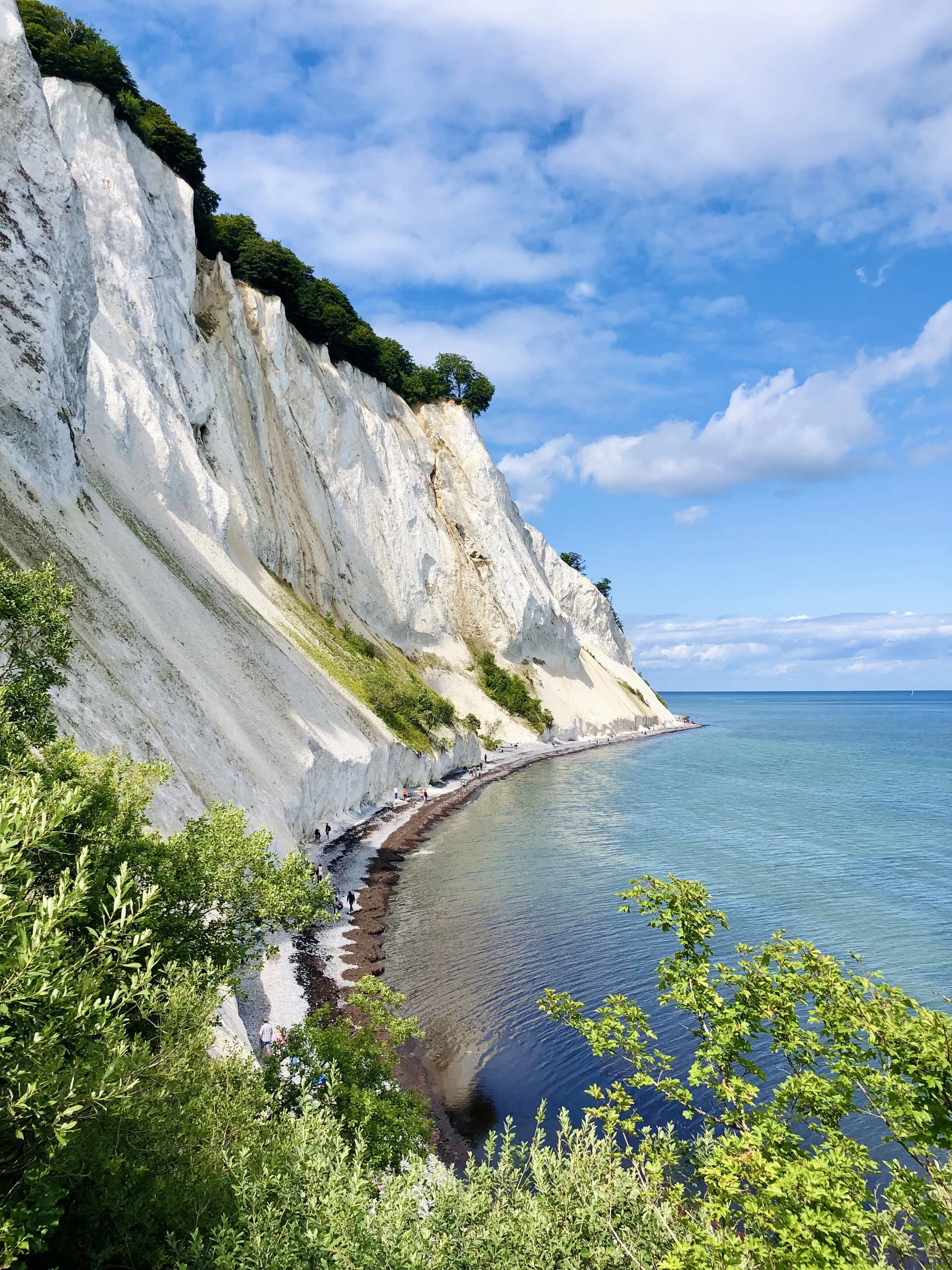
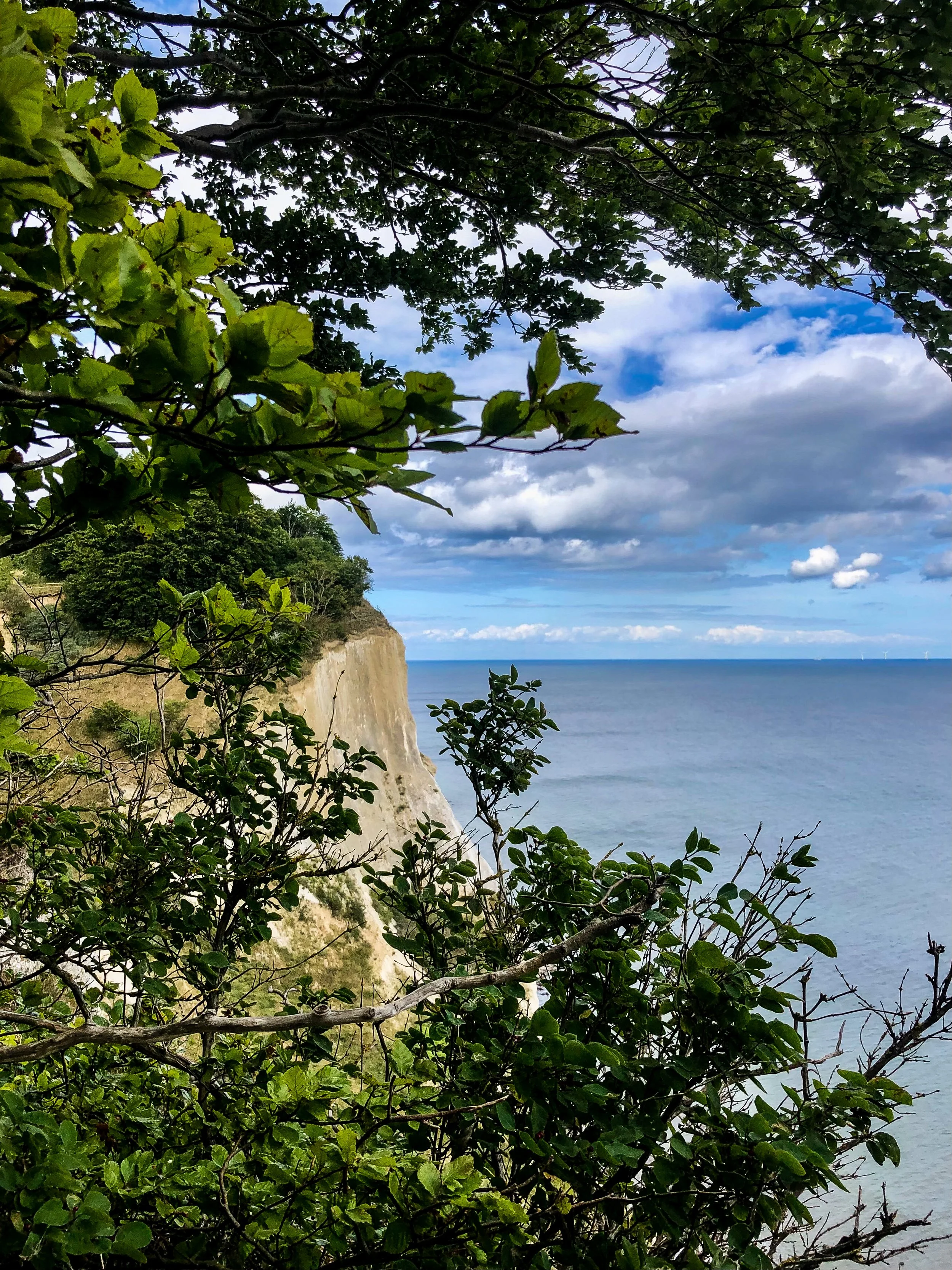
When visiting my sister in Copenhagen, we were craving something wild and scenic, and Møns Klint absolutely delivered. Just under two hours from the capital city, this coastal hike took us through the lush Klinteskov forest and out to one of Denmark’s most dramatic landscapes. The trail runs so close to the cliff that you can see the sea shifting below through the trees. Towering white chalk cliffs rise more than 120 meters above the turquoise Baltic Sea, and we followed a trail that traced the cliffside almost the entire way.
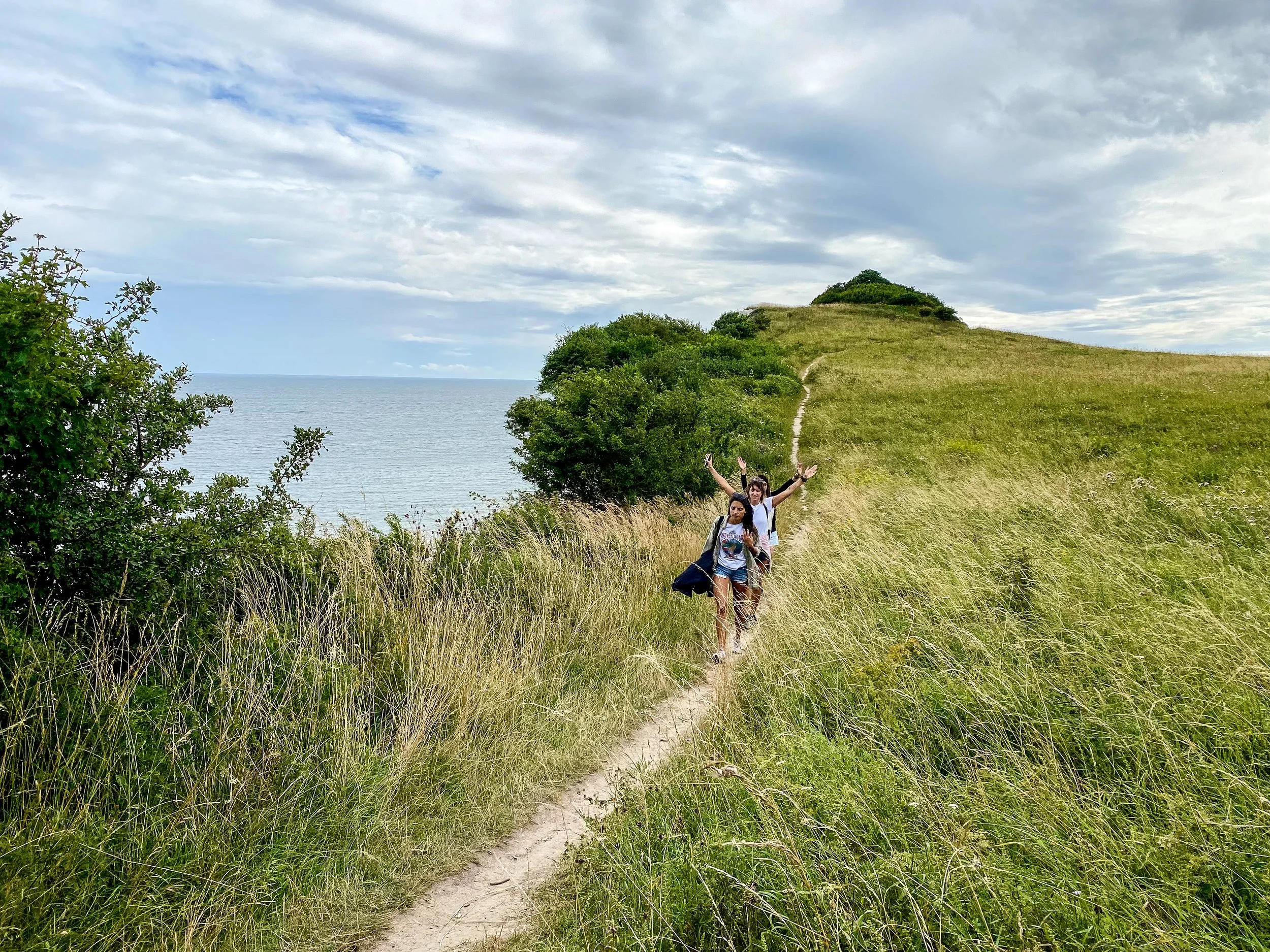
We hiked a 6 km loop starting at the GeoCenter, winding through dense beech woods, heading down steep wooden stairs, and climbing back up again (our thighs got a serious workout). Throughout the trail, the sea kept appearing between the trees, shifting in color and mood with the light and wind. It felt like stepping into a Nordic fairytale with an ancient forest behind us, an endless sea ahead, and a path that kept surprising us at every turn.
📍 Hike Details
Start/End: GeoCenter Møns Klint, Borre
Distance: 6.11 km
Duration: 2h50 (with breaks + photos)
Elevation Gain: 180 m
Trail Type: Loop—cliff path + forest
Møns Klint gave us white cliffs, forest silence, steep stairways, raw sea air, and that quiet awe of walking through a landscape still being shaped by time.
If you have been to Rügen’s Königsstuhl cliffs in Germany, you might recognize the bright white limestone formations and steep coastal slopes. Both landscapes were formed more than 70 million years ago during the Cretaceous period, when this region lay beneath a shallow sea. Despite their shared origin, Møns Klint offers a very different experience. The cliffs here are higher, steeper, and much more geologically active. You can see recent landslides, blocks of limestone scattered along the beach, and clear signs of ongoing erosion. Rügen’s cliffs feel more contained, with structured trails, fenced viewpoints, and a polished visitor experience. Whereas Møns Klint feels raw and dynamic. The landscape is still shifting, and you walk through it as it changes around you.